[ 3] Name on the Register[ 4]
Image
Date listed[ 5]
Location
City or town
Description
1
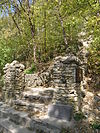
Birdsall Lime Kiln Upload image March 21, 1979 (#79000948 ) Northeast of Decorah 43°18′08″N 91°46′02″W / 43.302222°N 91.767222°W / 43.302222; -91.767222 (Birdsall Lime Kiln ) Decorah
2
Broadway-Phelps Park Historic District Broadway-Phelps Park Historic District November 13, 1976 (#76000813 ) West Broadway from Winnebago Street to Park Drive, also 202 Winnebago St., 307 West Main St. 43°18′01″N 91°47′35″W / 43.300278°N 91.793056°W / 43.300278; -91.793056 (Broadway-Phelps Park Historic District ) Decorah Second set of address represent a boundary increase approved March 14, 2022
3
Burr Oak House/Masters Hotel Burr Oak House/Masters Hotel January 27, 1983 (#83000410 ) State Street 43°27′28″N 91°51′56″W / 43.457778°N 91.865556°W / 43.457778; -91.865556 (Burr Oak House/Masters Hotel ) Burr Oak Laura Ingalls Wilder Museum
4
Burr Oak Savings Bank Burr Oak Savings Bank August 8, 2001 (#01000857 ) 3608 236th Ave. 43°27′30″N 91°51′55″W / 43.458333°N 91.865278°W / 43.458333; -91.865278 (Burr Oak Savings Bank ) Burr Oak Museum Visitor Center
5
Calmar Passenger Depot Calmar Passenger Depot March 21, 2011 (#11000137 ) 201 N. Maryville St. 43°11′02″N 91°51′53″W / 43.183889°N 91.864722°W / 43.183889; -91.864722 (Calmar Passenger Depot ) Calmar Advent & Development of Railroads in Iowa MPS
6
Cooley-Whitney House Cooley-Whitney House January 25, 1980 (#80001461 ) 305 Grove St. 43°12′45″N 91°48′03″W / 43.2125°N 91.800833°W / 43.2125; -91.800833 (Cooley-Whitney House ) Decorah
7
Decorah Commercial Historic District Decorah Commercial Historic District August 21, 2017 (#100001482 ) Blocks 500-100 W. Water, 100-200 E. Water, 100 Washington, 100 Winnebago, parts of W. Main, Court & W. Day Spring 43°18′15″N 91°47′16″W / 43.304205°N 91.787759°W / 43.304205; -91.787759 (Decorah Commercial Historic District ) Decorah
8
Decorah Hospital Upload image June 20, 2023 (#100009067 ) 305 Montgomery St. 43°18′06″N 91°46′37″W / 43.301802°N 91.777014°W / 43.301802; -91.777014 (Decorah Hospital ) Decorah
9
Decorah Ice Cave Decorah Ice Cave December 20, 1978 (#78001269 ) Ice Cave Road 43°18′38″N 91°47′03″W / 43.310556°N 91.784167°W / 43.310556; -91.784167 (Decorah Ice Cave ) Decorah
10
Decorah Municipal Bathhouse and Swimming Pool Decorah Municipal Bathhouse and Swimming Pool January 30, 2012 (#11001057 ) 701 College Dr. 43°18′49″N 91°48′05″W / 43.313625°N 91.801286°W / 43.313625; -91.801286 (Decorah Municipal Bathhouse and Swimming Pool ) Decorah
11
Decorah Woolen Mill Decorah Woolen Mill January 26, 2001 (#00001681 ) 107 Court St. 43°18′18″N 91°47′18″W / 43.305°N 91.788333°W / 43.305; -91.788333 (Decorah Woolen Mill ) Decorah
12
Ellsworth-Porter House Ellsworth-Porter House August 6, 1975 (#75000702 ) 401 West Broadway 43°17′59″N 91°47′48″W / 43.299722°N 91.796667°W / 43.299722; -91.796667 (Ellsworth-Porter House ) Decorah Porter House Museum
13
Fort Atkinson Bridge Fort Atkinson Bridge May 15, 1998 (#98000460 ) 150th Street over the Turkey River 43°09′12″N 91°55′43″W / 43.153333°N 91.928611°W / 43.153333; -91.928611 (Fort Atkinson Bridge ) Fort Atkinson
14
Fort Atkinson Historic District Fort Atkinson Historic District February 27, 2013 (#13000036 ) 2nd St. & 8th Ave. 43°08′45″N 91°56′22″W / 43.145885°N 91.939369°W / 43.145885; -91.939369 (Fort Atkinson Historic District ) Fort Atkinson U.S. Army fort maintained 1840–1853 to oversee Ho-Chunk people relocated from Wisconsin. Now Fort Atkinson State Preserve .[ 6]
15
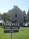
Frankville School Frankville School November 14, 1978 (#78001272 ) State Street 43°11′20″N 91°37′18″W / 43.188889°N 91.621667°W / 43.188889; -91.621667 (Frankville School ) Frankville
16
Gilliece Bridge Upload image May 15, 1998 (#98000464 ) Cattle Creek Road over the Upper Iowa River 43°24′54″N 91°57′32″W / 43.415°N 91.958889°W / 43.415; -91.958889 (Gilliece Bridge ) Bluffton Destroyed by overweight truck May 2017[ 7]
17
Highlandville School Highlandville School February 5, 2014 (#13001141 ) 3499 Highlandville Rd. 43°26′34″N 91°40′06″W / 43.442722°N 91.668277°W / 43.442722; -91.668277 (Highlandville School ) Decorah
18
Horn House Horn House March 25, 1977 (#77000568 ) Northwest of Decorah 43°20′33″N 91°49′32″W / 43.3425°N 91.825556°W / 43.3425; -91.825556 (Horn House ) Decorah
19
Jacobson Farm Jacobson Farm June 14, 1982 (#82002645 ) Junction of County Road W42 and 162nd Street, southeast of Decorah 43°10′21″N 91°45′54″W / 43.17238°N 91.76508°W / 43.17238; -91.76508 (Jacobson Farm ) Decorah
20
Kinney Octagon Barn Kinney Octagon Barn November 19, 1986 (#86003191 ) Off U.S. Route 52 43°28′21″N 91°52′04″W / 43.4725°N 91.867778°W / 43.4725; -91.867778 (Kinney Octagon Barn ) Burr Oak
21
Koren Library Koren Library January 12, 1984 (#84001610 ) Luther College campus43°18′38″N 91°48′14″W / 43.310685°N 91.804008°W / 43.310685; -91.804008 (Koren Library ) Decorah
22
Lawrence Bridge Upload image May 15, 1998 (#98000462 ) 330th Avenue over the Little Turkey River 43°04′58″N 92°03′08″W / 43.082778°N 92.052222°W / 43.082778; -92.052222 (Lawrence Bridge ) Jackson Junction
23
Locust School Locust School May 22, 1978 (#78001270 ) North of Decorah 43°25′14″N 91°43′22″W / 43.420556°N 91.722778°W / 43.420556; -91.722778 (Locust School ) Decorah
24
Luther College Campus Historic District Luther College Campus Historic District March 2, 2021 (#100006184 ) 700 College Dr. 43°18′45″N 91°48′10″W / 43.312368°N 91.802680°W / 43.312368; -91.802680 (Luther College Campus Historic District ) Decorah
25
Luther College Farm Luther College Farm July 17, 1979 (#79000949 ) Luther College campus43°19′04″N 91°48′05″W / 43.317778°N 91.801389°W / 43.317778; -91.801389 (Luther College Farm ) Decorah
26
Norris Miller House Norris Miller House June 8, 1976 (#76000814 ) 118 N. Mill St. 43°18′19″N 91°47′31″W / 43.305278°N 91.791944°W / 43.305278; -91.791944 (Norris Miller House ) Decorah Part of Vesterheim Norwegian-American Museum
27
Milwaukee and St. Paul Railway Combination Depot Milwaukee and St. Paul Railway Combination Depot September 12, 2016 (#16000609 ) 203 W. Pearl St. 43°17′55″N 91°47′15″W / 43.298515°N 91.787480°W / 43.298515; -91.787480 (Milwaukee and St. Paul Railway Combination Depot ) Decorah
28
Ossian Opera House Ossian Opera House June 18, 1979 (#79000950 ) Main Street 43°08′41″N 91°45′53″W / 43.144722°N 91.764722°W / 43.144722; -91.764722 (Ossian Opera House ) Ossian
29
Painter-Bernatz Mill Painter-Bernatz Mill January 11, 1974 (#74000816 ) 200 N. Mill St. 43°18′21″N 91°47′32″W / 43.305833°N 91.792222°W / 43.305833; -91.792222 (Painter-Bernatz Mill ) Decorah Part of Vesterheim Norwegian-American Museum
30
Steyer Bridge Steyer Bridge January 4, 1983 (#83000411 ) Oneata Road off U.S. Route 52 43°17′54″N 91°48′39″W / 43.298333°N 91.810833°W / 43.298333; -91.810833 (Steyer Bridge ) Decorah
31
Steyer Opera House Steyer Opera House January 24, 1980 (#80001462 ) 102-104 W. Water St. 43°18′12″N 91°47′21″W / 43.303333°N 91.789167°W / 43.303333; -91.789167 (Steyer Opera House ) Decorah
32
Wenzil Taylor Building Wenzil Taylor Building March 21, 1979 (#79000951 ) Main Street 43°12′20″N 91°57′13″W / 43.205556°N 91.953611°W / 43.205556; -91.953611 (Wenzil Taylor Building ) Spillville
33
Upper Bluffton Bridge Upload image May 15, 1998 (#98000458 ) Ravine Road over the Upper Iowa River 43°24′18″N 91°55′12″W / 43.405°N 91.92°W / 43.405; -91.92 (Upper Bluffton Bridge ) Bluffton
34
Washington Prairie Methodist Church Washington Prairie Methodist Church January 29, 1980 (#80001463 ) Southeast of Decorah 43°14′17″N 91°44′38″W / 43.238056°N 91.743889°W / 43.238056; -91.743889 (Washington Prairie Methodist Church ) Decorah


